The district of Santa Susanna de Peralta is located at the south-western end of Peratallada and borders on Sant Climent de Peralta, taking as reference the current route of the C-255 road from Girona to Palamós.
The settlement of the district is made up of various farmhouses, some of them converted into second homes. Traditionally, the population has lived through field farming.
In the land of Santa Susanna there are the remains of a bakery that is considered pre-Roman -Iberian- by the few pieces of pottery that, very crushed and eroded, were found on the outskirts. Currently, these remains, which are located a short distance from Can Serra, near a quarry in disuse, are virtually destroyed.
In the fields and forests near the castle, fragments of Roman type and Iberian-Roman ceramics were found. The scattering and low abundance of these superficial, sporadic findings, do not allow us to locate, not even roughly, the place or places where the old settlement was established.
The church of Santa Susanna de Peralta is located about 200 metres north of the castle, in a hollow beside the right bank of the Peralta stream. It is a small Romanesque temple, of extraordinary beauty, that has a single nave with a semicircular apse that was the subject of remarkable reforms in the 17th and 18th centuries. It is in a good state of conservation thanks to the significant restoration that took place in 1976 and 1977. The apse is decorated with Lombard slats or lashes, and has a double-bottom window and rounded arches.
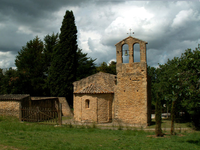
At the north side of the temple, at the far end of the nave, there is a square-bell tower that was unfinished or partly demolished. At the moment only the bottom part remains up to the height of the cover of the nave. On the east wall of this tower a bell tower was built with two rounded arches on rectangular pillars, also Romanesque. The interior of the bell tower is connected to the nave by means of a mid-point arch, from the baroque period.
How to get there
Other places

Canapost, is a small village located at the foot of some low rolling hills, in the south-eastern nature reserves of the Gavarres. This village is made up of a small group of farmhouses built beside the parish church of Sant Esteve, one of the most significant archaeological monuments in the region.
Some other farmhouses scattered around also belong to this parish. In the village there is a beautiful road that leaves Vulpellac and leads to Peratallada and Ullastret. Canapost is separated from the village of Peratallada by the hill called ‘Puig d'en Torró’.
The most popular element of the town is undoubtedly the parochial church of Sant Esteve, which seems to have been previously dedicated to Saint Clet, the third pope.
.jpg)
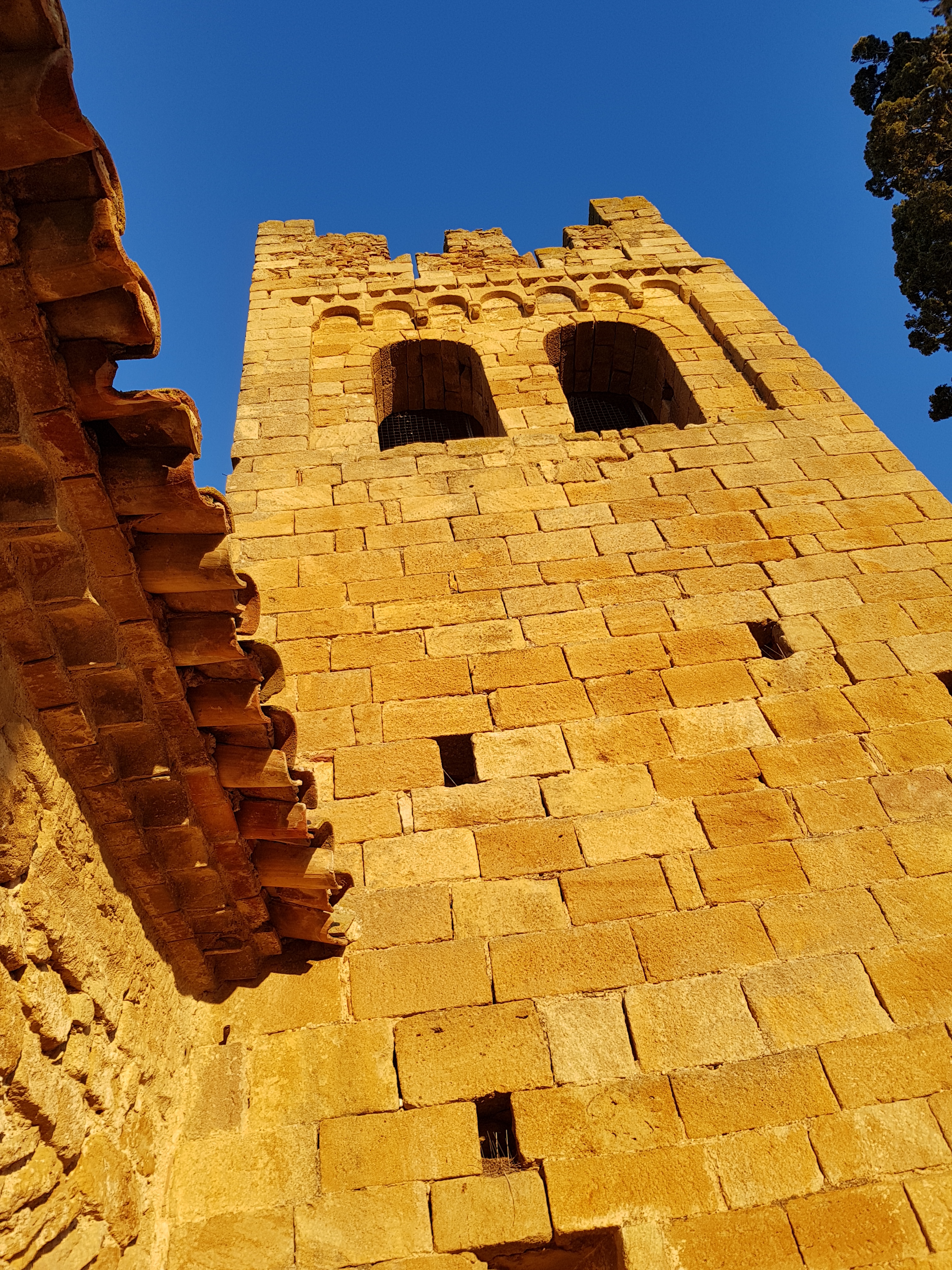
The present monument has different structures that belong to successive constructive stages. The church is made up of two juxtaposed buildings, one is pre-Romanesque and the other is Romanesque, with a bell tower, which is also Romanesque. The primitive temple nave has been preserved with few alterations, and has been classified in the pre-Romanesque period II. This magnificent building justifies a visit to Canapost.
The Canapost site is mentioned in a document from the year 901 under the name of Caneposto. In the founding of canonical life in Girona Cathedral, from the year 1019, it refers to a lodge in the parish of Canapost. The etymology of the place name has not yet been clarified. It has been said, however, that cana may refer to a milestone or stone on the path, on the assumption that it would coincide with the location of the place beside an old path.
In Canapost you can check the continuity of settlement, thanks to the various archaeological remains found, at least from the Roman period to the present day. Some remains of great interest have been preserved, such as the late medieval altarpiece or cist of the Mas Puig-sec - an asymmetric anthropomorphic hawk excavated on the rock that was pointed outwardly with vertical slabs - or the quarries known as the Clots of Sant Julià, which were probably operational at a time prior to Romanisation and during the Middle Ages, when it seems that a rock sanctuary was built. To the west of the quarries, near the Mas Ral, there is another archaeological pavement with Iberian ceramics. The traces of a section of what was once the old Camí d'Empúries, one of the main Roman roads that connected this villa with Girona, have also been preserved. On the other hand, in front of the church of Sant Esteve and the nearby farmhouses, remains of Roman settlements have been found. All of this is the object of great interest and architectural and archaeological appeal.
Another significant place can be found at Puig dels Socors.
.jpg)
On the north-eastern slope, remains have been found of pre-Roman settlements, just where the ruins of the chapel of Mare de Déu dels Socors are now found. This is a place that is highly recommended for visitors, especially for the view. Josep Pla described the place: «Els Socors is an excellent vantage point to contemplate this area of Romanesque land, a vivid medieval feeling and quality outstanding landscapes. From the hill we can see the walls and towers of Peratallada, Palau-sator, Boada, Pals, Castell d'Empordà, Llavià, among the lands of a divine grace.» The remains of the Mare de Déu dels Socors evoke the beauty and majesty of one of the most unknown temples of our architectural heritage. This singular chapel, dating from the 17th century, is located on the west side of Canapost, on the hill that gives it its name. It was all backed with a defence tower attached to the rear, and lost the roof and part of the stones that formed the openings, most likely as a result of a plundering. Despite its charm and value, it is a rather unknown element, which is not found in any of the tourist guides in the area. A visit is highly recommended, especially because of its privileged location, from which there are magnificent views. Josep Pla considered it one of the most privileged viewpoints of the Empordà.

This is a place located in the middle of the forest, in the heart of the Gavarres with a very special charm and personality.
With lush forests of cork oaks and pine groves and some clearings, it is a welcoming environment for walkers, cyclists, hikers and for everyone else passing by. It is a quiet place that is full of history and conveys a special magic. The beautiful landscapes, thanks to the views that can be seen on the plain and thanks to its personality, can only be perceived by someone who sees it in person.
The origin of the name of Fitor, which means landmark or term, in both its figured and real sense, is uncertain. Joan Botey, one of the largest owners of the area and a researcher of this place, maintains that it could come from the moment of maximum territorial splendour of the county of Empúries (9th century), in which the boundaries went from Corberes in Roselló, up to this mountain range. The name appears written for the first time in the year 948 at the time of the consecration of its parish, but it already appears as one of the founding towns integrating the present village. The settlement of the Fitor mountains is immemorial. In this area, there are a large number of megalithic monuments, close to each other, some of which are large, and evoke the presence of a culture that was very prevalent in our era.
In Fitor we can find the densest dolmen village in the Gavarres area, and one of the main ones in Catalonia.
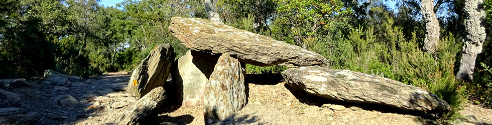
A significant number of these funerary constructions are still in a good state of preservation, made with large stone slabs, which show a good part of their original structure. In the area of Fitor there are fifteen dolmens, a menhir and several sacrifice stones. The best known are in the Serra de Cals, where the dolmen of Tres Peus, Tres Caires and the Serra de Calçó, are very well preserved, from which there are spectacular views of the Gavarres massif. Click here to see the routes of the dolmens in Fitor.
The most symbolic element of Fitor, apart from its forests, paths and streams, is without a doubt the church of Santa Coloma.
.jpg)
This is one of the jewels of the Gavarres massif, it is a Romanesque church that stands majestically on a small plain. The most singular and characteristic element of the building is its great bell tower, visible from most of the massif. The Lombard influence of Catalan Romanesque is presented in the decoration of the windows on the upper floor of the bell tower, with an arcade frieze. Together with the rectory and the cemetery, it forms a small group. The most milled roads are those that take you from Fonteta, Sant Climent de Peralta -where it connects with the Girona-Palamós motorway-, Mont-ras and Coll de la Ganga.
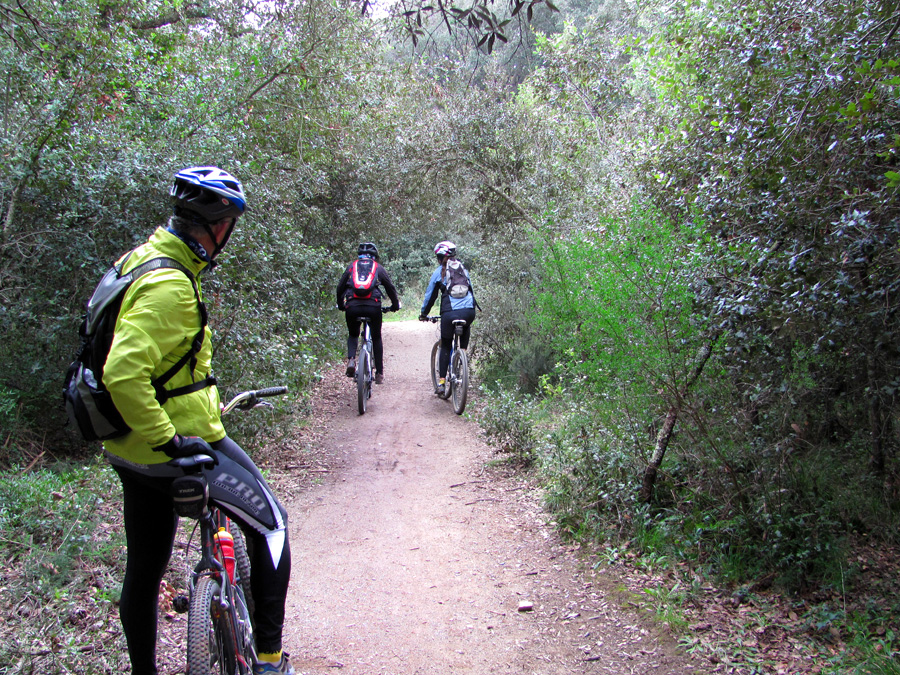
In addition to the historical and heritage value of the megalithic tombs and the church of Santa Coloma, Fitor, offers an unbeatable setting for practising activities related to active tourism: cycling, mountain biking or hiking. Fitor is a special place, especially for those seeking tranquillity

The village of Fonteta is located at the foot of the Gavarres massif. The hamlet forms a compact set of narrow streets around the parish church of Santa Maria.
Some of its streets still retain the ancient cobblestone and give it a characteristically rural aspect of a markedly Empordà town. It is crossed by the old road that linked La Bisbal with the coast, passing through the old neighbourhood of Fitor. This fact shows that Fonteta has been a strategic point in the area's communication network over the centuries. Prior to aggregation into the municipality of Forallac, the municipal district of Fonteta had an area of about 24 square kilometres, stretching along the north-eastern slopes of the Gavarres massif. It included a small rather flat sector, in contact with the Daró plain. The rest of the district was mountainous, and it reached the coll de la Ganga, which borders the towns of La Bisbal, Cruïlles and Calonge, to the northern slope of the Puig del Caragol, and to the south, the boundary with Calonge, Palamós and Vall-llobrega. It also included the towns of Fitor, the neighbourhood of Abellars and the old town of Torroella de Mont-ras. The fountain that gave its name to the town is the one that we can still find today on the same side of the church and that is still flowing. This fountain has been recently renewed and it has an inscription that explains the relationship between it and the name of the site. The rural village of Fonteta was donated by Carles el Calb to the Bishop of Girona in 844, along with another rural town called Apiliares, which is identified with the neighbourhood of Abellars. In 904, when Bishop Servusdei consecrated the parish of La Bisbal, he granted the tithes and the first fruits of the Church of Fonteta. The town belonged, later, to the barony of the Bisbal. From this municipality it managed to become independent in the second third of the nineteenth century.
The most singular and remarkable building in the village, apart from some houses of great historical and architectural value, is the parish church of Santa Maria, which was already known to exist in 904.
.jpeg)
The current temple preserves the Romanesque nave, from the 11th century, which was later modified. The Romanesque apparatus can be seen on the western façade, where a Renaissance door and a rose window were opened. The temple has recently been refurbished. The houses of the village are from the 16th and 17th centuries, with vaults in the lower parts and embedded in the floors, thresholds with inscriptions and dates. The streets are narrow, well-arranged, and all of them give an air of a very traditional rural town. The economy of the town has been closely linked to the exploitation of natural resources and agriculture. The population has traditionally lived looking towards the Gavarres and working the fertile lands of the plain. From this direct story there are many testimonials, such as lime kilns, which are very characteristic throughout the municipality.
Located in the heart of the Baix Empordà and in the interior of the Costa Brava, the village is in a place that has charm and personality and in an unbeatable setting for practising activities linked to active tourism because it is at a point of departure and arrival of several routes for cycling and hiking, one of them is the well-known one as the route of the dolmens of Fitor.

In the middle of the heart of Empordà and just a few kilometres from the best coves and beaches of the Costa Brava, the village of Peratallada is located in the province of Girona, halfway between Barcelona and the French border.
The ease of access, the good weather, the uniqueness of popular events, the richness of the historical and cultural heritage and the wide range of activities offered by the area make the village of Peratallada an ideal place to spend a good holiday be it as a couple, with friends, with family or individually. Apart from its architectural and historical attractions, the town is renowned for its significant artisan and, above all, gastronomic offer. The alleyways of the village are full of numerous and suggestive restaurants of all kinds, which offer the perfect complement to a visit to the village.
(1).jpeg)
A historic-artistic and cultural centre of national interest
The village, declared a historical-artistic and cultural centre of national interest, is one of the most important villages of Catalonia in terms of medieval architecture. With extraordinary appeal and beauty, it preserves its ancient feudal appearance, with narrow and tortuous streets and numerous entrances and alleyways. The route through the town allows you to discover different points of view of the castle-palace and the walls and various popular architecture. The whole town is located on sandstone rock, worked in various ways. There is no doubt that the most impressive elements are the wall valleys, with trenches excavated into the live rock.
.jpg)
Therefore, the meaning of the name of Peratallada, remains obvious to those who visit the population (the noun is formed by ‘pedra’ + ‘tallada’, which literally mean ‘stone’ + ‘engraved’). Peratallada was one of the most fortified Catalan populations. The defence system was formed by three walled enclosures (the main one with the castle at the centre and two others that were to the north and east) protected by the trenches excavated in the rock of unknown and debatable chronology. Where it is currently visible, they are about 7 or 8 meters deep. The highlights are the fortified castle with its tribute tower and the palace (11th-14th C.), the walls (12th-13th C.) and the church of Sant Esteve (Romanesque at the beginning of the 13th century). Also worthy of note is the great moat that surrounds the town, excavated into the live rock. The whole town is seated on sandstone rock, worked in various ways. A curious fact, and one that is worth noting is that Berenguer de Cruïlles (1310-1362), bishop of Girona and the first president of the Generalitat de Catalunya, was a native of this town.
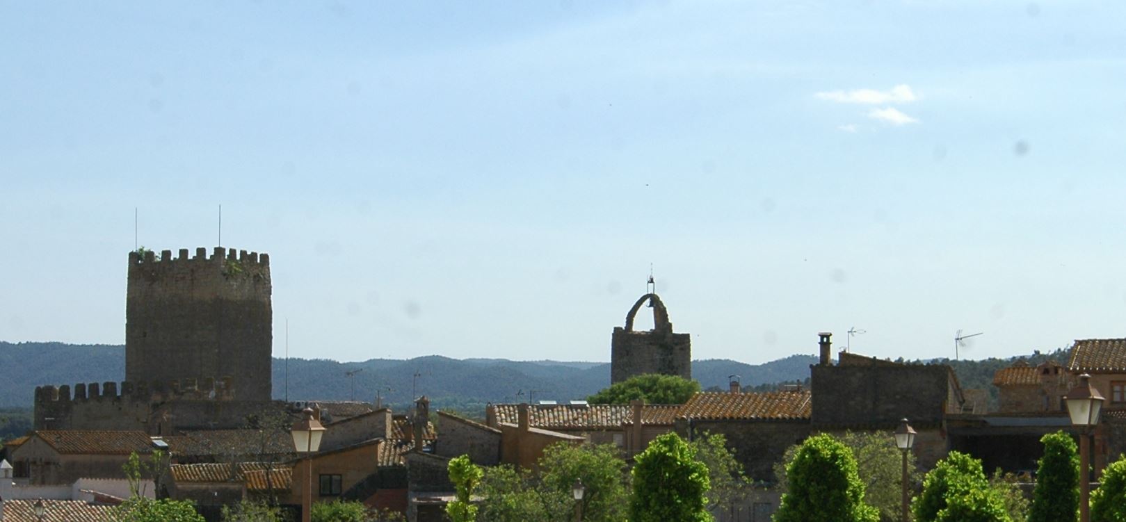
The castle of Peratallada, around which the town settled, was the centre of the barony that belonged to the aforementioned lineage of Peratallada, documented from the 11th century. The castle has been proved to have existed in 1065, but some architectural structures seem to show that this village already had an even older fortress. The fortified village is raised above an enormous rocky base of natural sandstone, artificially cut to give it verticality.
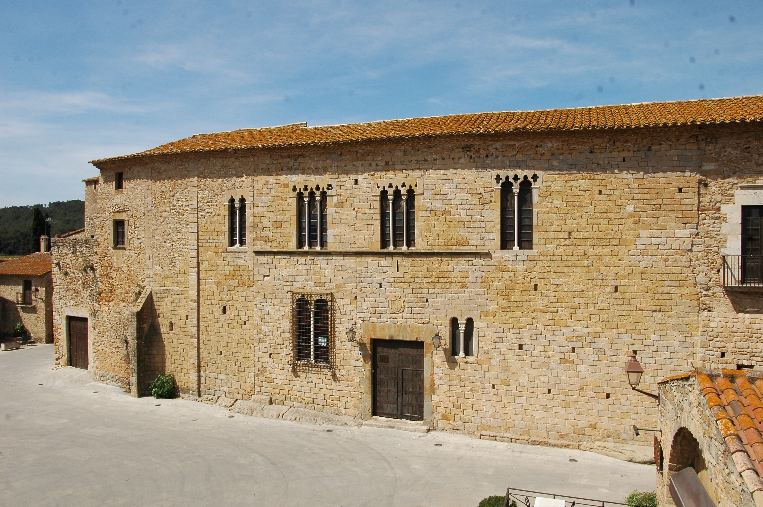
The rocky mound rises 4 or 5 meters above the surrounding terrain. On top of it stands the great castle, with its characteristic tribute tower, and the magnificent palace, oriented to the east, that faces the Castle Square. Also you can see remains of battlements (spaces to defend itself between the solid stone) that give great attraction and mysticism to the construction. The high tribute tower, the identity landmark of the town, is rectangular and crowned by square battlements. It has a sloping door and had an intermediate wooden floor. It is constructed with rows of squared ashlars.
Petra scissa or Petra Tallada
The place name Petra scissa or Petra Tallada is documented, apparently, from the 10th century. Later on, the name refers to a few modifications to the people or to the different characters of the Peratallada lineage, which eventually became one of the most significant in the Baix-Empordà roots. Thus, for example, in 1062 there is mention of a Bernardi de Patra Taliada, in 1065 Castro de Petra Taliata appears. In 1088 we find Petrataliata, 1111 Petra Taliata, 1112 Petra Talata, 1128 Petra Incisa and Patra Taiata, 1143 Petra Tayada, 1169 and 1173 Petra incisa, 1202 and 1222 Petricissa, etc.

The village of Sant Climent de Peralta originates from the old monastery located in a small, narrow valley of Les Gavarres, in the vicinity of the tramuntana. No so long ago - 18th C. - the church of the old monastery was abandoned and the new parish was built, about two kilometres to the east, in the nature reserves of the mountain range closest to the plain, where the population of country houses moved to, characterising the location. Sant Climent had to be, as Pella and Forgas indicated, one of the first monastic, Benedictine colonisations of the country.
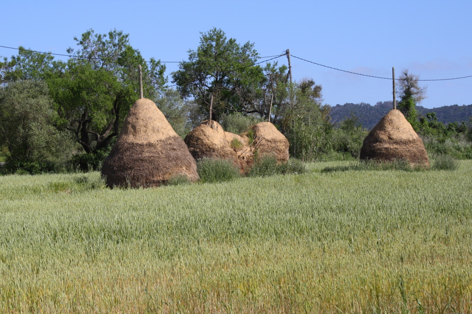
The monastery was placed in a hidden corner, in the valley of a ridge with slopes staggered over cultivated terraces and near to a fountain, which has now almost stopped. Lets imagine that in the high-medieval era the place would have been even more shady and would have had more scrambling vegetation than at present. It seems that this site was populated before the monastic establishment. The tiles that can be seen between the walls of the church ruins may come from a building from Roman times. However, remains of a necropolis with tombs protected with tegula have been discovered that could be prior to the first documents that tell us about the monastic cell.
The ruins of the church of the monastery of Sant Climent de Peralta are known by the name of the old church of Mas Vidal, a 19th century house, that is currently inhabited. This was to be built with most of the stones from the demolition of part of the church, and perhaps from other medieval buildings that had disappeared.
The inhabitants of Sant Climent de Peralta have traditionally been living from the fields and the exploitation of the natural resources of the Gavarres massif: cork, firewood, coal, etc ... The town farmhouses thrived with the exploitation of cork. Then, when the vines in France were attacked by phylloxera, much of the farmland was transformed into vineyards. Currently, the settlement is made up of dozens of farms, some of them converted into second homes.
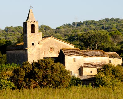
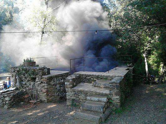
Sant Climent de Peralta's church
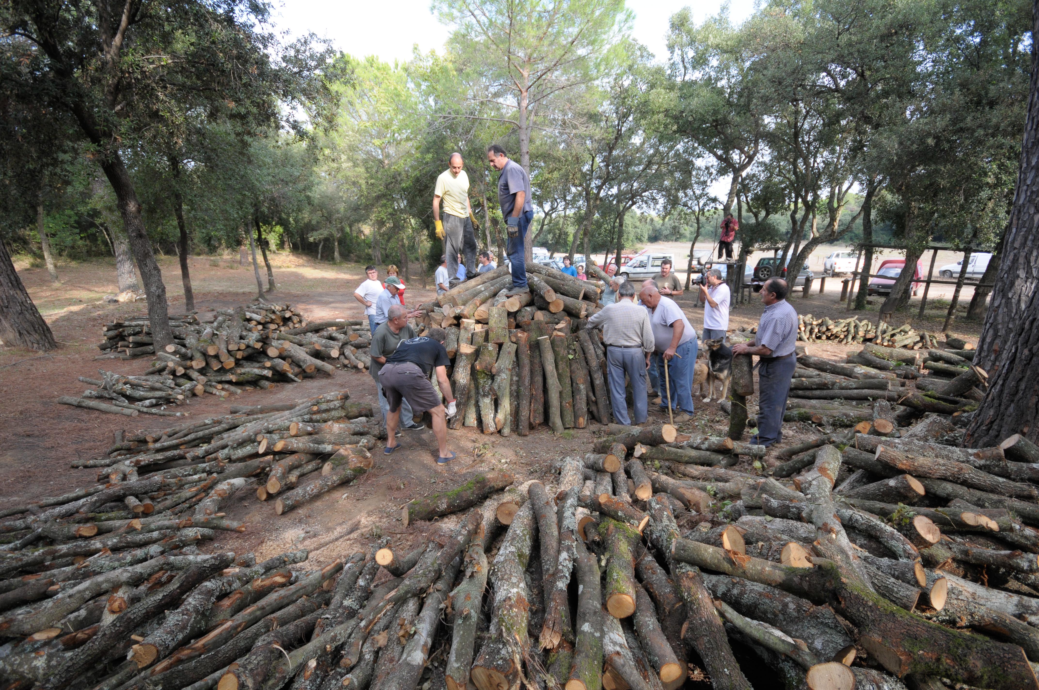
La Carbonera
La Rajoleria del Mas Frigola
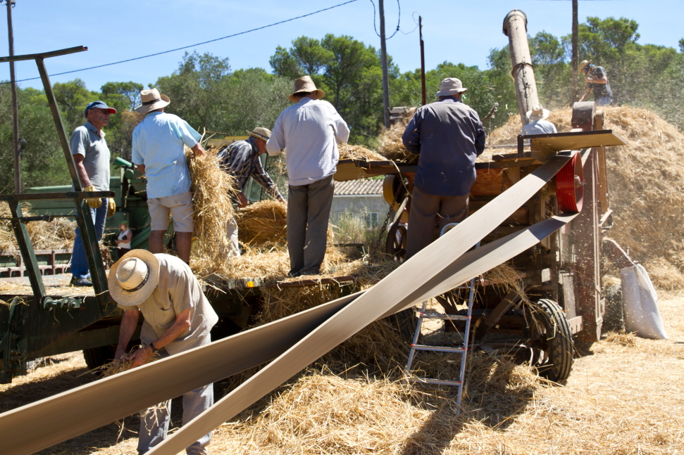
Festa del segar i del batre
In Sant Climent, however, it is still possible to breathe the atmosphere belonging to a place that is closely linked to the massif. The village has some of the most beautiful and enchanting places of the Gavarres, which make it an excellent place for hiking and discovering the natural environment of this important space.
How to get there

The town is made up of an old town with remarkable architectural interest, which is structured around the elements that make up the castle-palace and the parish church of Sant Julià and Santa Bassilissa. The old town was declared in 2009 by the Directorate General of Heritage of the Generalitat as a cultural asset of national interest in the historical group category.
The elements conserve a good part of the characteristics that are typical of the medieval Catalan towns. According to the text from the Government's agreement, the town "articulates throughout its grounds, a series of routes and spaces of architectural interest that invite contemplation and intrigue through the old town of this municipality", which "makes the integration and preservation of these historic elements especially necessary".
.jpeg)
The old municipality of Vulpellac covered, before the annexation with Fonteta and Peratallada, 4.29 square kilometres. The district comprises a hilly area, on the west and north east with the highest point in the puig Negre (109 meters high), which is part of the Serra de Sant Ramon, a limit with the neighbouring district of ??La Bisbal d'Empordà. The remaining part is flat and drained by the Fonteta stream, from the Daró basin, which descends from the Gavarres. The road from Palamós to Girona, through La Bisbal, crosses the municipal territory from east to west. At the point where this road crosses through the town of Vulpellac, the local road that goes to Pals begins and passes through Canapost, Peratallada and Palau Sator. As in so many villages of the Empordà, a good number of houses have been converted into second homes and restored respecting the property values ??of the buildings. Outside this village there are numerous farms spread across the neighbourhood of the plain and somewhat throughout the district, which has two other significant populated areas: the neighbourhood of La Bordeta, which emerged in the nineteenth century along the Girona road, and the urbanisation of Puig de Sant Ramon.
Due to its location - along the road from Girona to Palamós and La Bisbal -, a large number of industries have been installed in the district, mainly related to ceramics or artificial stone. In order to consolidate and give order to this industrial potential, the urbanisation of the industrial estate began in 1999, where Nexes is now found, the nursery for Forallac companies, created with the aim of boosting the economy of the township. It is a facility for the temporary location of small businesses so that entrepreneurs have at their disposal a set of services at an affordable price that facilitate the operation of their company during the first years of its start-up.